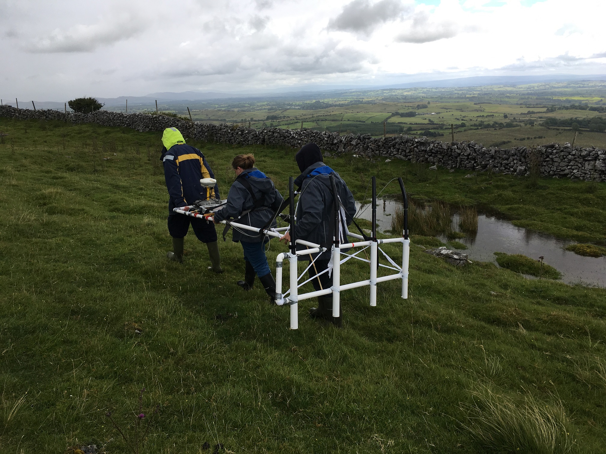
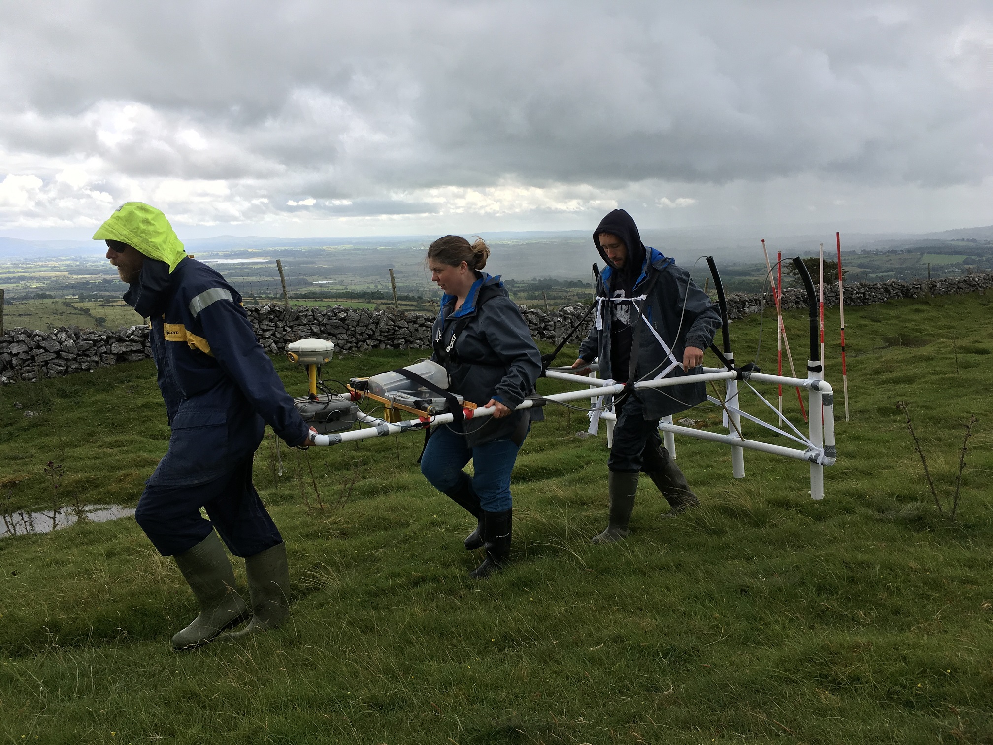
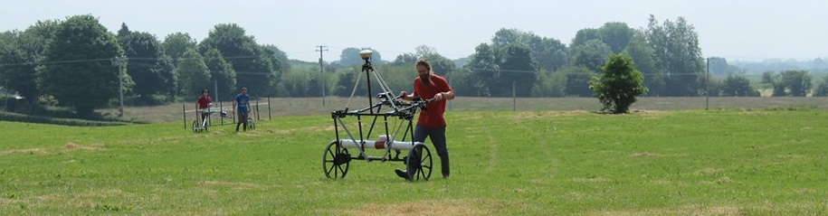
On top of the hill with the Earthwalker Magnetometer Array
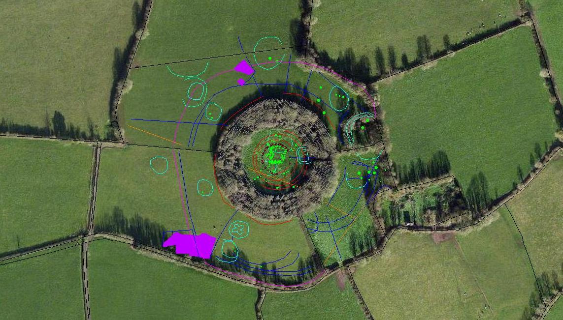
Survey of Knocknashee hillfort interior using Earthsound’s Earthwalker Magnetometer Array
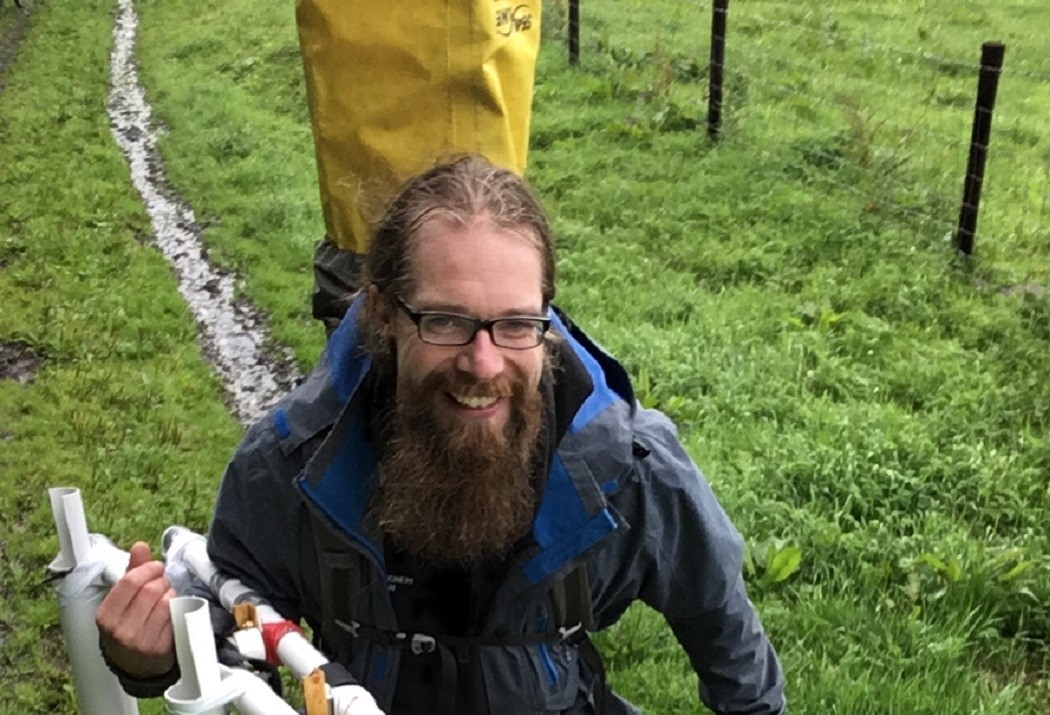
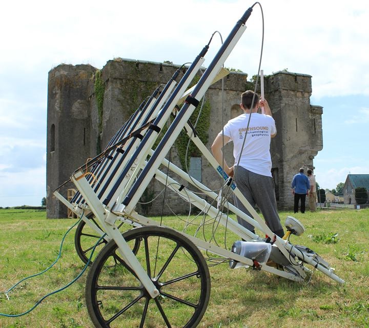
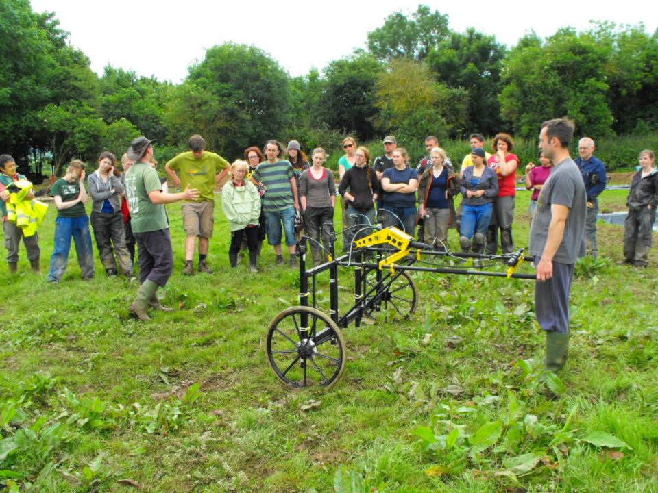
Our latest magnetometer array is the Earthwalker – the first in-house piece of equipment created by Earthsound Geophysics. The Earthwalker was designed, sourced and built by Earthsound’s Cian Hogan, with input and help from all staff.
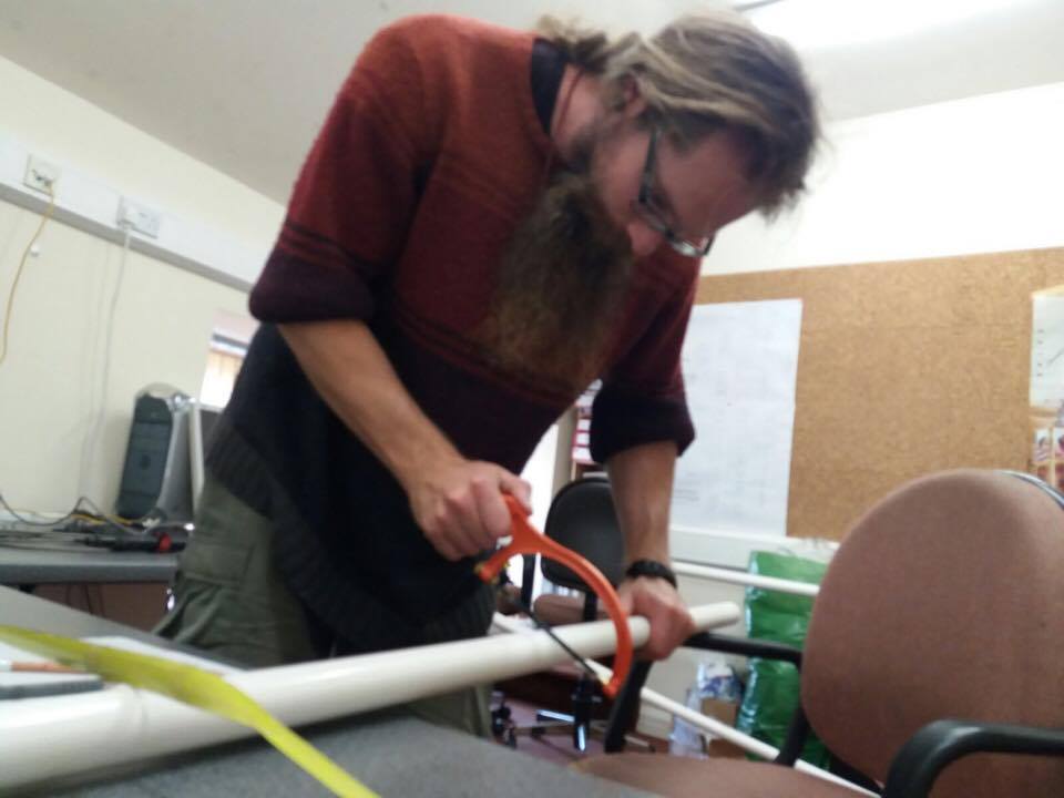
Cian constructing the Earthwalker
Our regular multi-sensor magnetometer array uses a wheeled cart – however, due to increasing demand to undertake fieldwork in remote and challenging terrain, a more suitable and sturdy option was required. From uplands and rocky outcrops to dunefields and the inter-tidal zone, Earthsound’s new Earthwalker array allows us to carry out high-resolution GPS-acquired magnetometry no matter what the terrain.
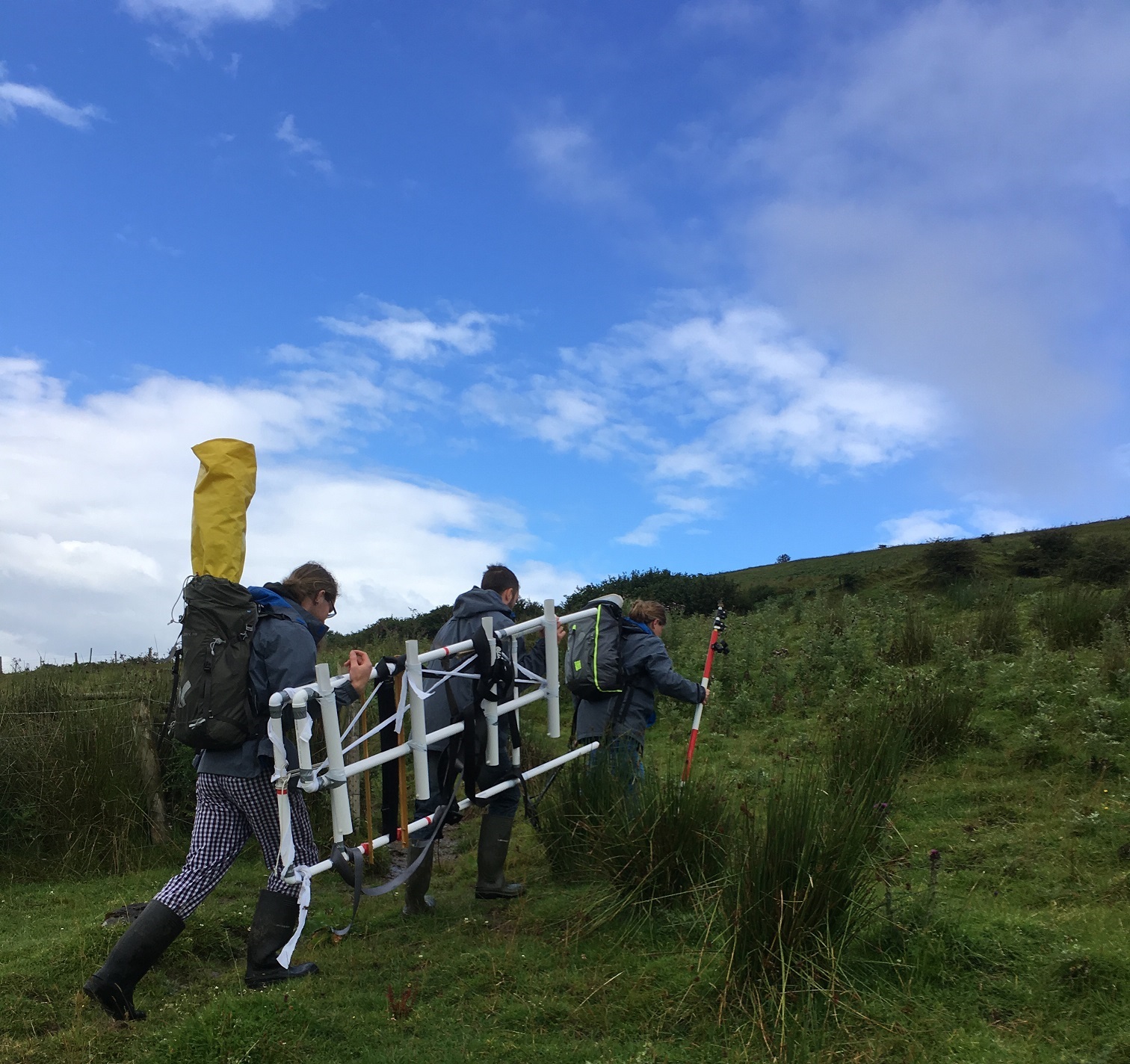
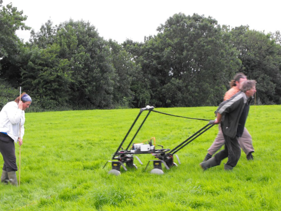
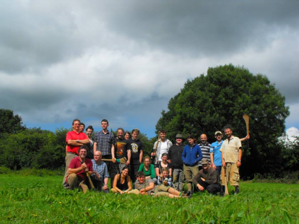
The Earthwalker had its maiden survey at Knocknashee Hillfort, as part of the 2017 season of the Knocknashee Archaeology Project – and it was a great success! It took 8 people to transport our survey gear – 2 x GPS, 8 x ranging rods, food for the day (most important!), a metal detector, survey flags, 4 x magnetometers, an electronics box, and the Earthwalker array – to the top of the hill.
Heading up Knocknashee with the Earthwalker
Earthsound surveyors worked together to collect data over 9 Ha of data, developing a methodology and refining the array.The Earthwalker delivered the first large scale, high-resolution assessment of the Knocknashee hillfort interior.
Client: Dr. Dirk Brandherm, Queen’s University Belfast
Funding: Royal Irish Academy Grant (2016, 2017)
Aim: The purpose of the geophysical surveys was to assess hut sites on the plateau of Knocknashee, a hillfort complex which also contains two Passage Tombs. In 2016 the entire hillfort interior – more than 20 ha in size – was assessed with Magnetic Susceptibility to identify zonations of activity. Specific clusters of huts and enclosures were further investigated with high resolution Magnetometry and Earth Resistance surveys. The 2017 survey used the ‘Earthwalker’ Magnetometer array across the southern half of the plateau and targeted Metal Detection surveys.
Outcomes: The 2016 geophysical survey results are currently being written up for publication in a future edition of Emania. The results were used to target a series of excavations in 2017, under the direction of Dr. Dirk Brandherm.
Community Engagement: We’ve given a number of lectures on our work in Athy at the Athy Heritage Centre Museum, we’ve been visited by local schools and filmed for a short video that documented the surveys for the benefit of the local national school.
Outcomes: The 2013-2016 geophysical surveys have been used to aid the management of the Athy Town Walls and castles in a rapidly developing urban area. For more information on our work at Athy, see our collection of Blogs from Athy.
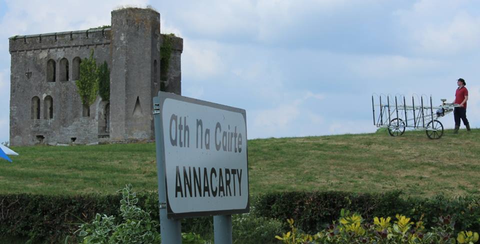
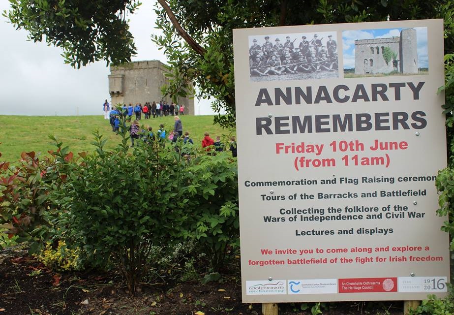
Aim: In June 2016, we carried out extensive Magnetometer, Electromagnetic Induction, Ground Penetrating Radar, Earth Resistance Surveys and Metal Detection surveys at the RIC Barracks in Annacarty as part of a large commemoration event which was also filmed by RTE’s new television series John Creedon’s Epic East. The film crew were very interested in the geophysical survey and obtained some great drone and GoPro footage of our work.
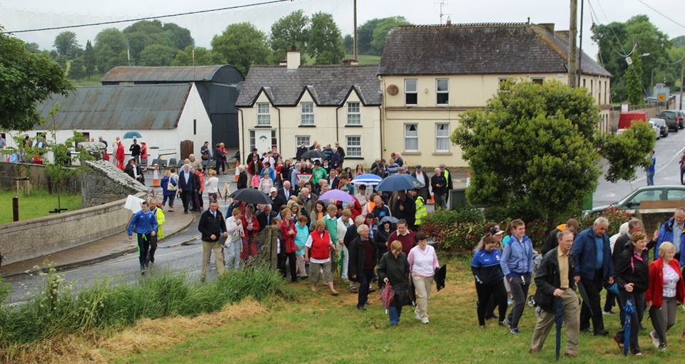
Community Engagement: 1 volunteer worked with Earthsound geophysicists for 1 day (volunteer labour contribution: €164). The survey was filmed for RTE television and culminated in a large commemoration on the last day of survey, attended by more than 220 people, with Earthsound geophysicists on hand to explain the survey, it’s purpose and findings.
Outcomes: The 2016 geophysical survey culminated in a large commemoration ceremony (see below) attended by local school children and adults, the Army and many local politicians. The survey results will be integrated in to a management plan for the site.
The geophysical surveys were carried out as part of a research project managed by Wolfhound Archaeology, funded by Tipperary County Council, Ireland 1916-2016 and The Heritage Council. The research formed part of the Annacarty Remembers event, which commemorated the events of the War of Independence and Civil War.
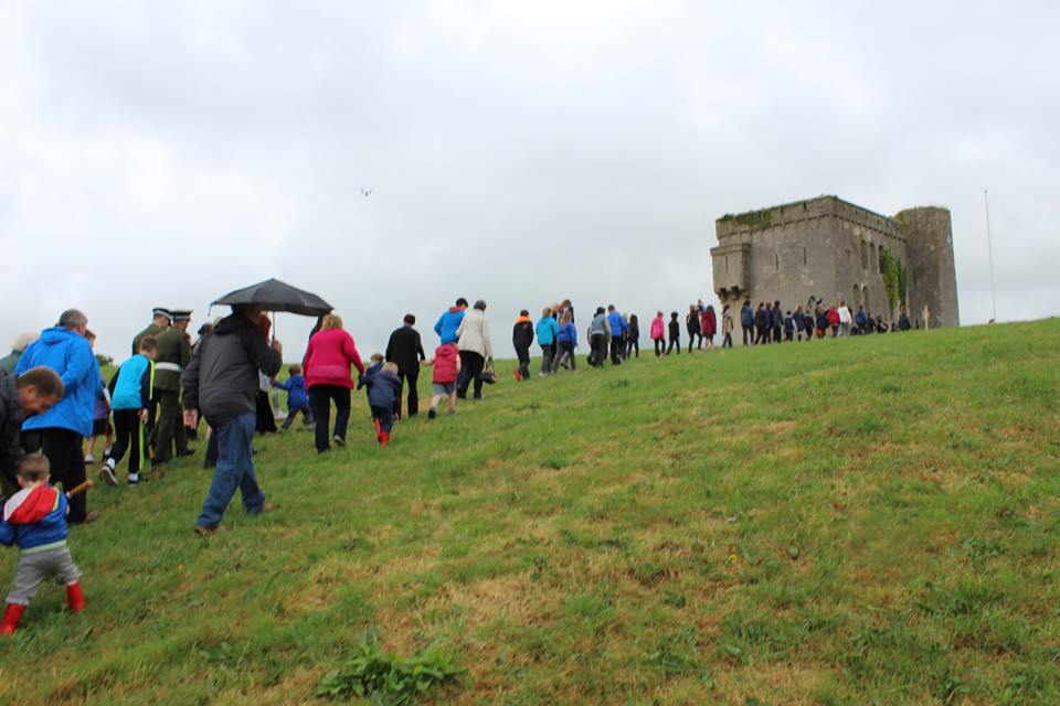
School children lead the procession up the hill towards the Barracks.
Annacarty Barracks, which was originally constructed as an RIC barracks in the early 19th Century, saw considerable action during the conflicts prior to the foundation of the Irish state.
In the spring of 1922, the truce had been signed and the barracks handed over to the volunteers. The children of Annacarty N.S. were marched up the hill to the barracks by the principal, Mr. Slattery and sang Amhrán na bhFiann for the volunteers as they raised the tri-colour.
The procession recreated the original event in 1922.
On June 10th 2016, the event was recreated by more than 220 school children, local residents and visitors. The building bears the scars of these battles but is otherwise virtually untouched since it was burnt out after a short but violent siege in 1922 during the Civil War.
The Annacarty Remembers gathering walking up the hill to the Barracks.
The surveys were led by Heather Gimson and supported by Dr James Bonsall, Darren Regan and Cian Hogan, who used various geophysical instruments to map additional structures around the barracks and carried out a detailed photogrammetry survey.
The magnetometer cart at rest by the RIC Barracks while John Creedon does some filming
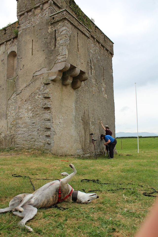
Recording bullet holes in the wall. In the meantime, the ‘Bone Detector’ takes a snooze.
Magnetometry and EMI carts
GPR in action at the RIC Barracks
We enjoyed wonderful hospitality from the people of Annacarty, who really welcomed us to their village. Particular thanks are due to Tom Tuohy, The Parish Shop & Tea Rooms and the Crossroads Pub (which kept us – and the dog – in great health with lots of ice creams and drinks.
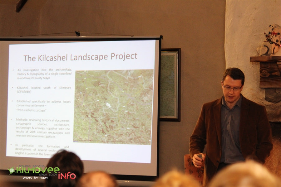
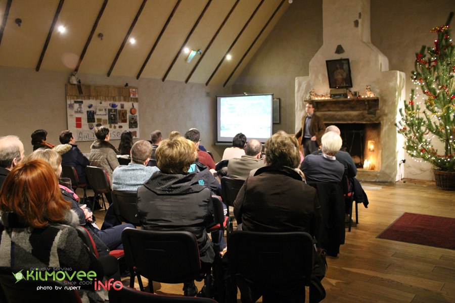
Dr James Bonsall, director of Earthsound Archaeological Geophysics and Lecturer at IT Sligo gave a talk on the latest findings from the Kilcashel Landscape Project at the Kilmovee Winter Lecture Series on Tuesday December 15th, in the Kilmovee Community Centre, Co. Mayo.
Dr James Bonsall talks at the Kilmovee Winter Lecture Series about the Kilcashel Landscape Project at Kilmovee.
James’ talk focused on the range of archaeological sites in Kilcashel, from Bronze Age fulacht fia to medieval cashels and 19th century mud cabins.
James was also interested in people’s use, experience or memories of the archaeological sites in Kilcashel townland – the cashels that are no longer there, Father Henry’s Fort and any other memories of buildings, archaeology and folklore. These all contributed to a Database of Archaeology in Kilcashel townland, which led to the longest Q&A session in the history of the Kilmovee Winter Lecture Series!
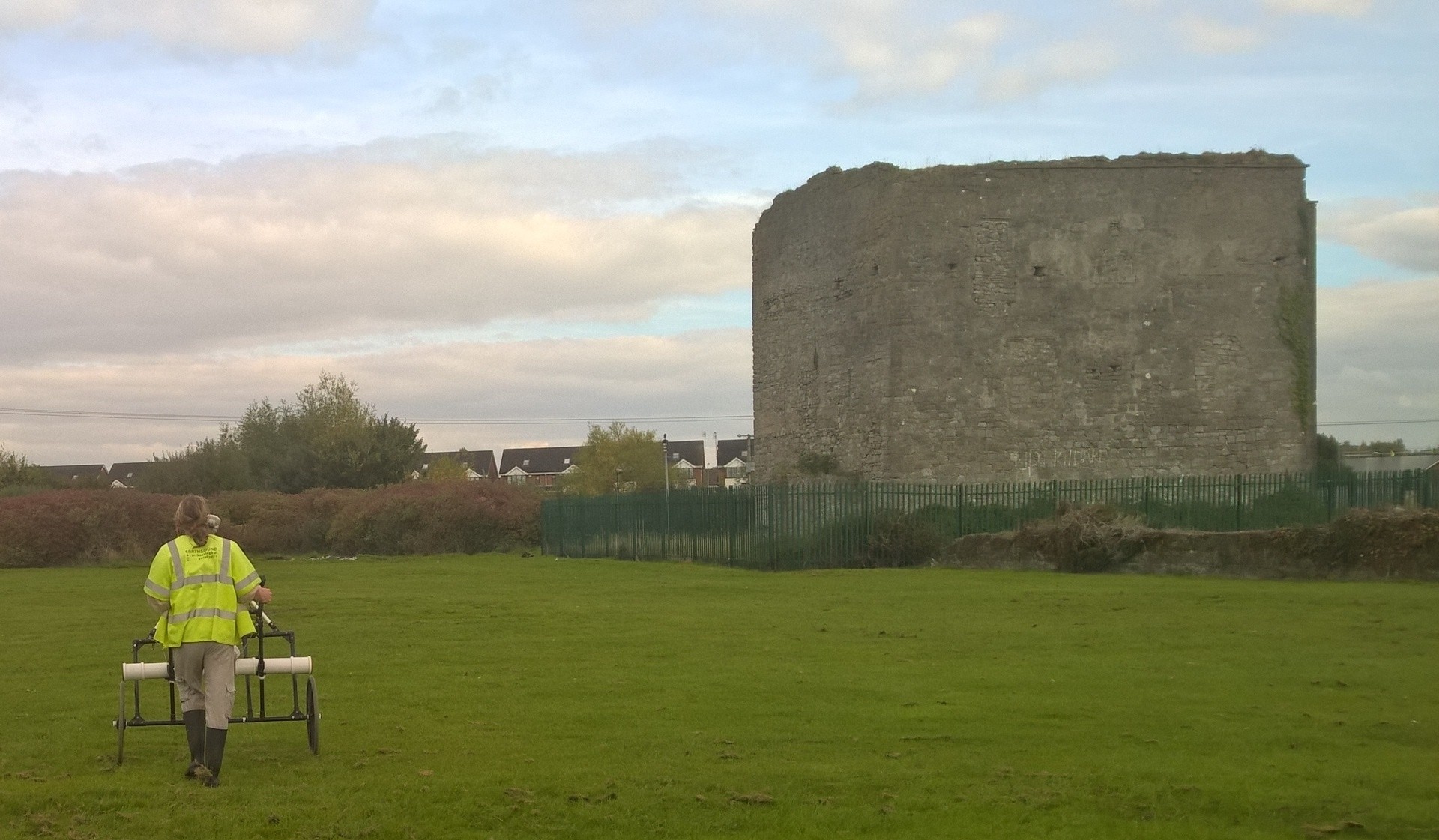
Yesterday, Earthsound Archaeological Geophysics had the pleasure of returning to Athy in County Kildare to carry out magnetometry and electromagnetic induction surveys at Woodstock Castle. This is the latest in a number of projects that we have carried out in Athy over the past few years, which have included geophysical and LiDAR investigations of the historic Town Walls and Black Castle Tower which have been a part of the ongoing efforts of the Athy Heritage Centre-Museum to inform locals and visitors alike on the wonderful history of their town!
Cian Hogan and Darren Regan of the Earthsound Field Division braved a cold October morning to survey the environs of the castle. Darren was filmed for a short video that documented the surveys for the benefit of the local national school.
We love returning to Athy each year to add a little bit more knowledge to the development of this important medieval town and this is just the latest in a long line of projects for the Athy Heritage Centre-Museum!
Since the year 2013, Earthsound have had an ongoing relationship with the Athy Heritage Centre-Museum in connection with The South Kildare Medieval Heritage Projecton a variety of projects which encompass geophysical surveys, historical research and public outreach campaigns. The first project we engaged in involved a number of geophysical surveys in order to detect the location and morphology of the historic town halls, an investigation we returned to again in another area of the town in October of 2016. The work carried out in October 2016 involved the use of Ground Penetrating Radar and led to the discovery of a number of significant anomalies such as possible walls, defensive structures and remains associated with a mortuary site.
As part of these ongoing projects, Earthsound has spoken and given demonstrations at a number of community activities based in the town in order to explain the work we have carried out and to hopefully give a greater understanding to the residents of the archaeological and historical heritage that surrounds them.
Athy is part of the Irish Walled Towns Network and Earthsound have undertaken similar studies on Cashel Walled Town and Castledermot Walled Town.
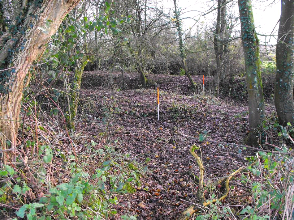
View of three banks and ditches overgrown by trees at Rathnadrinna.
Aim:
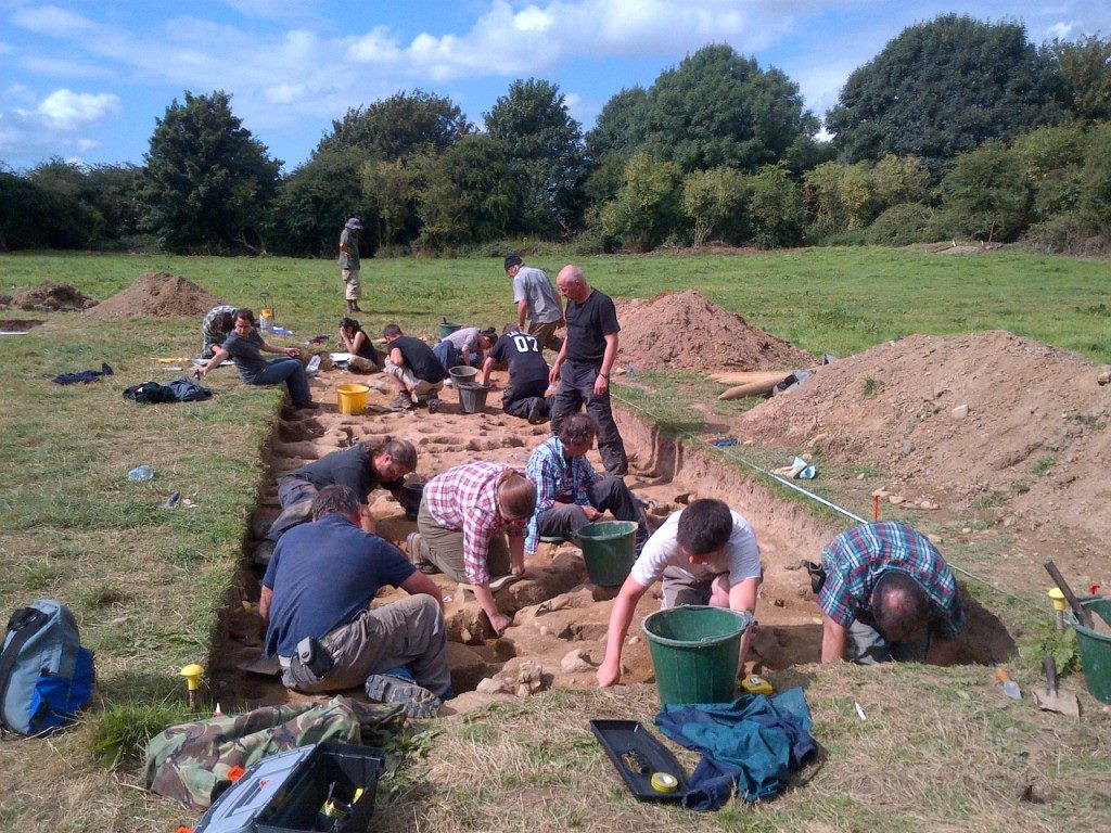
Rathnadrinna Fort is a multivallate hilltop enclosure in the townland of Lalor’s-Lot outside Cashel, Co. Tipperary. It is one of the most impressive of several hilltop enclosures surrounding Cashel. In 2009, a project lead by Richard O’Brien began to carry out extensive investigations of the fort in order to gain further understanding of the history of the site. These included documentary research, aerial photographs, geophysical surveys and LiDAR. Earthsound were involved in the geophysical and LiDAR investigations of the enclosure and surrounding lands. The results of this research led up to a series of archaeological excavations lasting three seasons from 2012-2014.
Heather, Tom and Mick using the Jalopy to collect earth resistance data inside the enclosure
Community Engagement:
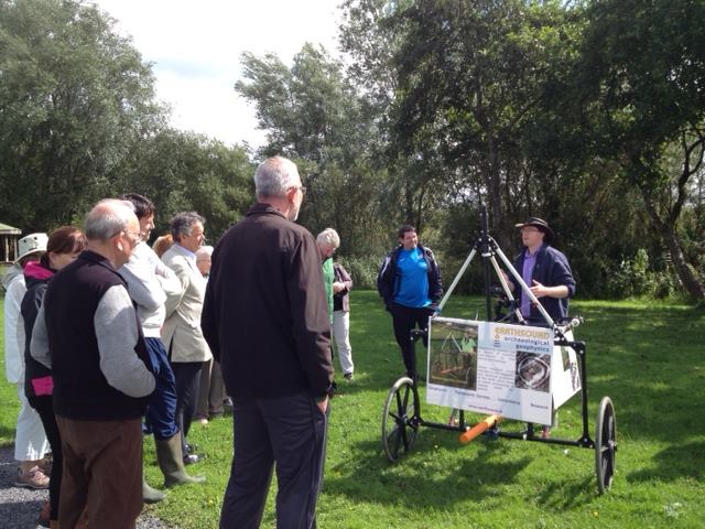
The Rathnadrinna Research project engaged members of the public throughout many of it’s stages. Locals and volunteers from all across the country and abroad were invited to join in the excavation team and be part of the project. Earthsound carried out a number of demonstrations of various geophysical techniques on site and some of the digging crew and visitors were able to get some hands on experience in operating the equipment.
Darren demonstrating the magnetometer cart
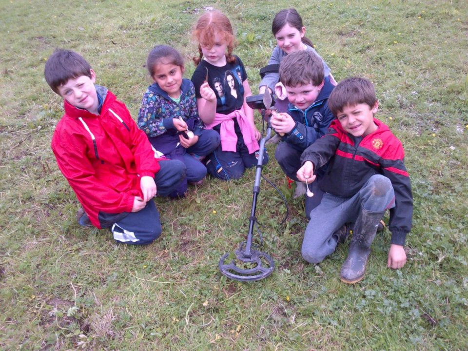
Loughmore National School children learning about metal detection
Geophysics: In 2009 we carried out high resolution magnetic susceptibility, magnetometry, earth resistance and ground penetrating radar surveys within Rathnadrinna Fort and in a surrounding field. The magnetic susceptibility and magnetometry data suggest an absence of occupation and industry inside Rathnadrinna, which could suggest by default a ceremonial or ritual role for the fort. Evidence for a (presumably prehistoric) field system which pre-dates the construction of Rathnadrinna was also found. Parts of the field system may be fossilised in the extant field boundaries of today and also hint towards a larger outer enclosure, also partly preserved in the modern field boundaries. The earth resistance survey identified 3 further circular enclosing ditches within Rathnadrinna fort and 1 possible ditch beyond the fort in Field 1, as well as a pit-circle at the centre of the fort. These suggest that Rathnadrinna may have been comprised of 6 concentric ditches (3 of which are extant), and a possible 7th ditch on the exterior. Combining this data with a potential larger outer enclosure comprised of extant outer field boundaries surrounding Rathnadrinna, suggests that possibly up to 8 circular enclosing features may have been identified.
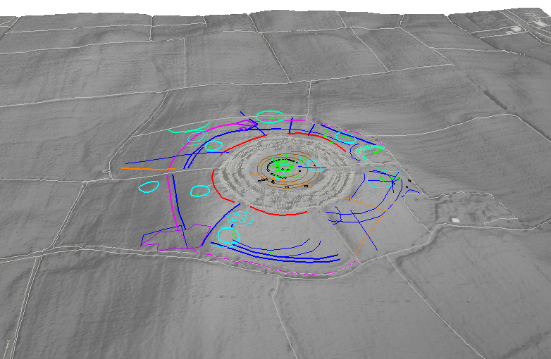
3D display of combined geophysics interpretation on top of LIDAR image
In 2010 further geophysical surveys were carried out including high resolution magnetic susceptibility, magnetometry and earth resistance and electrical resistivity tomography surveys. A number of linear and curvilinear ditches and possible ditches or gullies have been detected across the survey area. Many of these appear to be associated with relict field boundaries. 19th century activity was also identified in the form of two possible structural remains which match features on the 1st edition OS map. The hilltop of Rathnadrinna is surrounded by an enclosure ditch measuring 250m in diameter. This single ditch enclosed the top of the hillside and has influenced the arcing nature of some of the modern field boundaries. A large number of circular ring-ditches and arcing ditches have also been detected outside the known fort. These appear to fall into two distinct types based on their size and morphology. Small ring-ditches measuring 15m-19m in diameter may represent foundation slot-trenches or drip gullies surrounding (unrecorded) wooden structures. Larger circular features measuring 40m in diameter, similar to the upstanding remains of the known satellite fort beside Rathnadrinna. These anomalies may therefore represent possible ploughed-out ringforts. The magnetic susceptibility data suggests an absence of burning activity – like inside the fort – perhaps discounting a settlement role for the ring-ditches and ringforts indicating that they might be burial or ritual monuments.
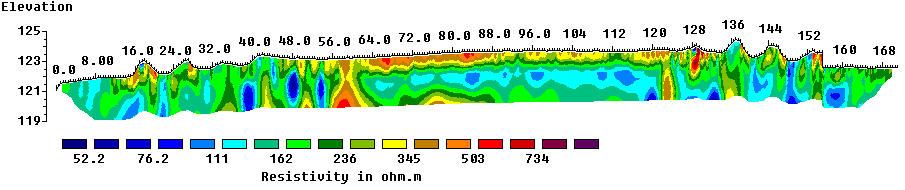
Electrical Resistivity Tomography (ERT) line running S-N across the monument including all banks and ditches.
Excavation:
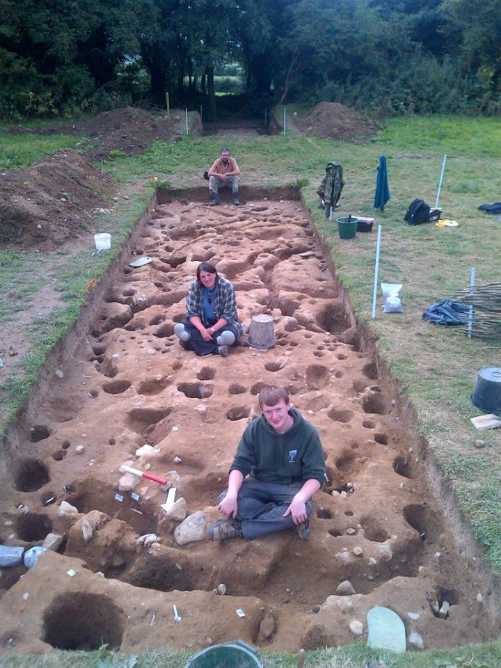
Three seasons of excavations, beginning in June 2012 and the final season concluding in August of 2014, were directed by Richard O’Brien. Earthsound’s Heather Gimson was part of the digging crew as archaeological supervisor throughout all of the excavations. Additional Geophysical data was collected and demonstrations of the survey techniques were carried out by our staff on several occasions during the excavation seasons.
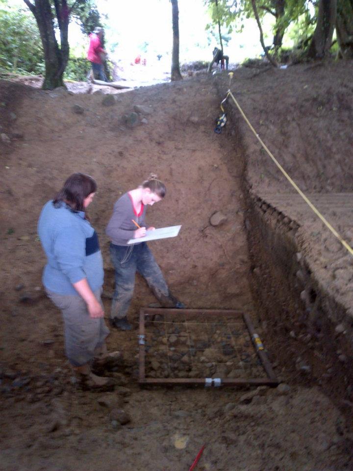
Heather and Meaghan planning stones in Ditch B, Season One 2012
Some of the crew, Season Two 2013
Cutting 1C at its busiest, Season Three 2014
Liam, Heather and Mick after finishing cutting 1C, Season Three 2014
Mayfield Lake, Wetlands and its Archaeological Heritage.
Earthsound director Dr James Bonsall gave a talk and guided walk on the archaeological heritage of Mayfield Lake and Clare Lake, Claremorris, as part of Heritage Week, in the Mayfield Community Building, in Claremorris on the 28th August.
The local audience joined in and told great stories of old place names and memories of fishing in Mayfield Lake. After the talk, James led the audience out to McMahon Park to let them carry out their own archaeological survey.
Town Walls and Castles – Recent Geophysical Discoveries in Athy.
Earthsound director Heather Gimson gave a lecture in the Athy Heritage Centre-Museum yesterday, County Kildare. Heather presented the results of our research on the Athy Town Walls and Castles which we’ve been working on for a number of years. This year we focused on using Ground Penetrating Radar and Electrical Resistivity Tomography over the Town Walls and Black Castle Tower which are located under a number of gardens and yards. The lecture was well attended and the audience included the Mayor of Athy.
Earthsound director Heather Gimson gave a lecture in the Athy Heritage Centre-Museum yesterday, County Kildare. Heather is working in Athy this week looking for evidence of the Town Walls and Castles using archaeological geophysical techniques. Heather explained the aims of the research and how geophysical surveys actually work. Many of those that attended the lecture are part of the project – the work currently involves surveying a number of peoples back gardens and yards to trace the medieval archaeology.
Heather will return to Athy in November to present the findings of the research.