
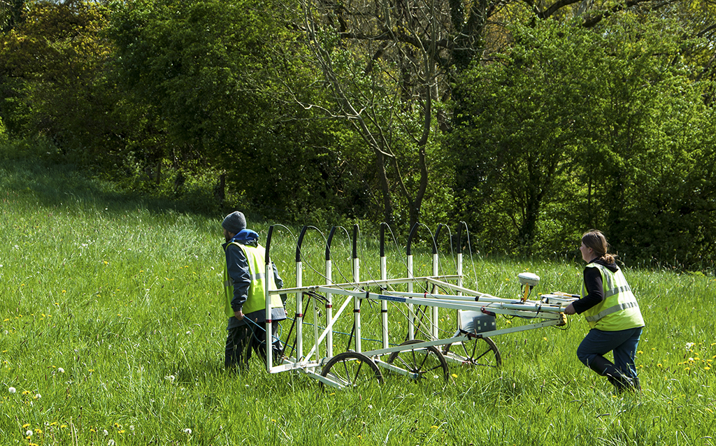
 Magnetometer surveys are the most frequently used geophysical technique in Ireland and the UK. Earthsound have a range of handheld and cart-mounted, gridded and RTK GPS-acquired systems which allow for the rapid mapping of magnetic anomalies within the sub-soil, producing a magnetic map of the underlying archaeology. Archaeological features such as kilns, furnaces, hearths and burnt mounds of stone create strong magnetic anomalies from burning and heating processes; other features such as infilled pits and ditches gain a natural magnetism over time which can also be detected across most soils.
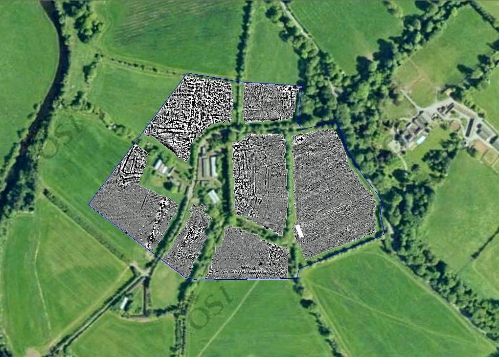
Example of Magnetometer survey results.
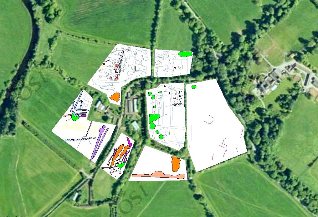
Interpretation drawing showing features detected by the Magnetometer survey.
© 2002- 2026 Earthsound Geophysics Ltd.